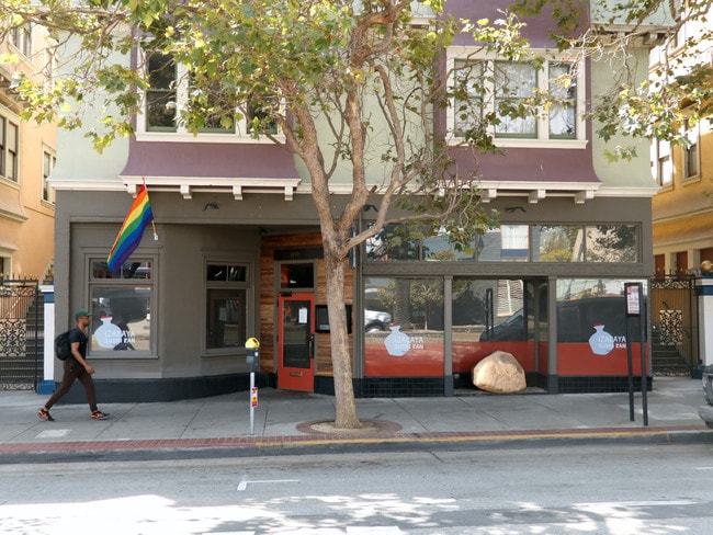
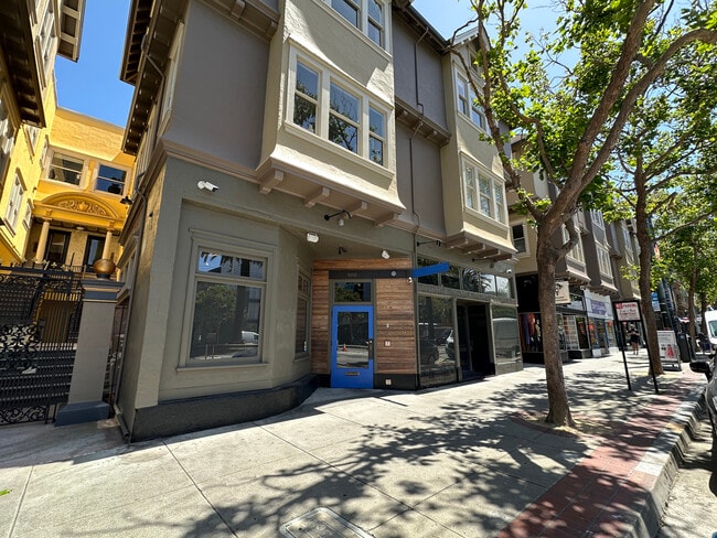
Property Record
230 Sanchez St, San Francisco, CA 94114

NEARBY LISTINGS FOR SALE OR LEASE
Property Detail
230 Sanchez St
San Francisco-Redwood City-South San Francisco, CA
Mission
3559-002
San Francisco
Apartment
California
2024
2
2025
0.49 AC
020300
Castro
54,945 SF
San Francisco
DEMOGRAPHICS near 230 Sanchez St
1 Mile
3 Mile
5 Mile
2024 Total Population
93,023
585,964
819,501
2029 Population
86,565
544,053
757,769
Pop Growth 2024-2029
(6.94%)
(7.15%)
(7.53%)
Average Age
42
42
42
2024 Total Households
44,865
267,214
344,817
HH Growth 2024-2029
(7.46%)
(7.60%)
(7.86%)
Median Household Inc
$151,583
$133,838
$125,447
Avg Household Size
2.00
2.10
2.20
2024 Avg HH Vehicles
1.00
1.00
1.00
Median Home Value
$1,109,963
$1,106,446
$1,095,630
Median Year Built
1947
1949
1949
Nearby Places
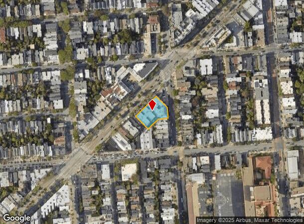
Map Layers
Map Styles
 Street
 Aerial
- Restaurants
- Banks
- Shops
- Fitness
- Groceries
PUBLIC TRANSPORTATION
TRANSIT/SUBWAY
Market And Sanchez (F Market - San Francisco Municipal Railway (MUNI Metro), MARKET & WHARVES - San Francisco Municipal Railway (MUNI Metro), MARKET & WHARVES BUS - San Francisco Municipal Railway (MUNI Metro))
DRIVE
WALK
Distance
Market And Sanchez (F Market - San Francisco Municipal Railway (MUNI Metro), MARKET & WHARVES - San Francisco Municipal Railway (MUNI Metro), MARKET & WHARVES BUS - San Francisco Municipal Railway (MUNI Metro))
0 min
1 min
0.1 mi
Market St & Noe St (MARKET & WHARVES - San Francisco Municipal Transportation Agency, MARKET & WHARVES BUS - San Francisco Municipal Transportation Agency)
DRIVE
WALK
Distance
Market St & Noe St (MARKET & WHARVES - San Francisco Municipal Transportation Agency, MARKET & WHARVES BUS - San Francisco Municipal Transportation Agency)
0 min
1 min
0.1 mi
Market And Noe (F Market - San Francisco Municipal Railway (MUNI Metro))
DRIVE
WALK
Distance
Market And Noe (F Market - San Francisco Municipal Railway (MUNI Metro))
1 min
2 min
0.1 mi
Market And Church Inbound (CHURCH - San Francisco Municipal Railway (MUNI Metro), F Market - San Francisco Municipal Railway (MUNI Metro), INGLESIDE - San Francisco Municipal Railway (MUNI Metro), J Church - San Francisco Municipal Railway (MUNI Metro), K Ingleside - San Francisco Municipal Railway (MUNI Metro), L Taraval - San Francisco Municipal Railway (MUNI Metro), M Ocean View - San Francisco Municipal Railway (MUNI Metro), OCEAN VIEW - San Francisco Municipal Railway (MUNI Metro), S Castro Shuttle - San Francisco Municipal Railway (MUNI Metro), T Third Street - San Francisco Municipal Railway (MUNI Metro), TARAVAL - San Francisco Municipal Railway (MUNI Metro))
DRIVE
WALK
Distance
Market And Church Inbound (CHURCH - San Francisco Municipal Railway (MUNI Metro), F Market - San Francisco Municipal Railway (MUNI Metro), INGLESIDE - San Francisco Municipal Railway (MUNI Metro), J Church - San Francisco Municipal Railway (MUNI Metro), K Ingleside - San Francisco Municipal Railway (MUNI Metro), L Taraval - San Francisco Municipal Railway (MUNI Metro), M Ocean View - San Francisco Municipal Railway (MUNI Metro), OCEAN VIEW - San Francisco Municipal Railway (MUNI Metro), S Castro Shuttle - San Francisco Municipal Railway (MUNI Metro), T Third Street - San Francisco Municipal Railway (MUNI Metro), TARAVAL - San Francisco Municipal Railway (MUNI Metro))
0 min
3 min
0.2 mi
Church And 16Th Outbound (CHURCH - San Francisco Municipal Railway (MUNI Metro), J Church - San Francisco Municipal Railway (MUNI Metro))
DRIVE
WALK
Distance
Church And 16Th Outbound (CHURCH - San Francisco Municipal Railway (MUNI Metro), J Church - San Francisco Municipal Railway (MUNI Metro))
1 min
4 min
0.2 mi
COMMUTER RAIL
San Francisco 4Th & King (Caltrain - Caltrain (Caltrain))
DRIVE
WALK
Distance
San Francisco 4Th & King (Caltrain - Caltrain (Caltrain))
6 min
2.5 mi
San Francisco Caltrain Station Southbound (Express - Caltrain (Caltrain), Limited - Caltrain (Caltrain), Local Weekday - Caltrain (Caltrain), Local Weekend - Caltrain (Caltrain))
DRIVE
WALK
Distance
San Francisco Caltrain Station Southbound (Express - Caltrain (Caltrain), Limited - Caltrain (Caltrain), Local Weekday - Caltrain (Caltrain), Local Weekend - Caltrain (Caltrain))
6 min
2.5 mi
AIRPORT
San Francisco International
DRIVE
WALK
Distance
San Francisco International
22 min
13.9 mi
Metro Oakland International
DRIVE
WALK
Distance
Metro Oakland International
33 min
21.4 mi
Freight Ports
Port of San Francisco
DRIVE
WALK
Distance
Port of San Francisco
9 min
3.3 mi
SALE & LEASE HISTORY
LISTING DATE
SALE/LEASE

Sep 21, 2018
For Lease
Jun 20, 2024
For Lease
Jul 30, 2019
For Lease
Jan 17, 2020
For Lease
Apr 14, 2021
For Lease
Nearby Properties
Address
Land Use
TOTAL SIZE
Lot Size
Zoning
Address
Land Use
TOTAL SIZE
Lot Size
Zoning
1,015,000 SF
2.43 AC
RC4
Address
Land Use
TOTAL SIZE
Lot Size
Zoning
764,661 SF
0.67 AC
C3OSD
Address
Land Use
TOTAL SIZE
Lot Size
Zoning
750,370 SF
3.25 AC
MBR3
Address
Land Use
TOTAL SIZE
Lot Size
Zoning
1,471,929 SF
1.93 AC
C3O
Address
Land Use
TOTAL SIZE
Lot Size
Zoning
1,300,000 SF
1.74 AC
C3O
Address
Land Use
TOTAL SIZE
Lot Size
Zoning
1,420,430 SF
1.16 AC
C3OSD
Address
Land Use
TOTAL SIZE
Lot Size
Zoning
1,534,312 SF
2.60 AC
C3O
Address
Land Use
TOTAL SIZE
Lot Size
Zoning
914,037 SF
1.36 AC
C3O
Address
Land Use
TOTAL SIZE
Lot Size
Zoning
248,303 SF
4.35 AC
Address
Land Use
TOTAL SIZE
Lot Size
Zoning
717,234 SF
3.47 AC
UMU
Address
Land Use
TOTAL SIZE
Lot Size
Zoning
605,459 SF
0.63 AC
C3O
Address
Land Use
TOTAL SIZE
Lot Size
Zoning
475,791 SF
0.55 AC
C3OSD
Address
Land Use
TOTAL SIZE
Lot Size
Zoning
690,442 SF
0.79 AC
C3O
Address
Land Use
TOTAL SIZE
Lot Size
Zoning
10.92 AC
Address
Land Use
TOTAL SIZE
Lot Size
Zoning
750,491 SF
0.51 AC
C3O
Address
Land Use
TOTAL SIZE
Lot Size
Zoning
432,000 SF
0.35 AC
C3OSD
Address
Land Use
TOTAL SIZE
Lot Size
Zoning
266,143 SF
4 AC
C-3-R
Address
Land Use
TOTAL SIZE
Lot Size
Zoning
885,581 SF
5.20 AC
M2
Address
Land Use
TOTAL SIZE
Lot Size
Zoning
512,395 SF
1.24 AC
C3O
Address
Land Use
TOTAL SIZE
Lot Size
Zoning
508,714 SF
1.29 AC
C3R
Address
Land Use
TOTAL SIZE
Lot Size
Zoning
1,084,662 SF
1.67 AC
C3O
Address
Land Use
TOTAL SIZE
Lot Size
Zoning
505,120 SF
0.41 AC
C3O
Address
Land Use
TOTAL SIZE
Lot Size
Zoning
694,334 SF
1.01 AC
C3O
Address
Land Use
TOTAL SIZE
Lot Size
Zoning
696,431 SF
0.97 AC
C3G
Address
Land Use
TOTAL SIZE
Lot Size
Zoning
139,070 SF
0.64 AC
C3O
Address
Land Use
TOTAL SIZE
Lot Size
Zoning
1.52 AC
C3G
Address
Land Use
TOTAL SIZE
Lot Size
Zoning
1,424,230 SF
2.60 AC
C3G
Address
Land Use
TOTAL SIZE
Lot Size
Zoning
614,740 SF
1.74 AC
C3OSD
Address
Land Use
TOTAL SIZE
Lot Size
Zoning
615,957 SF
0.63 AC
C3O
Address
Land Use
TOTAL SIZE
Lot Size
Zoning
492,980 SF
0.43 AC
C3O
The World's #1 Commercial Real Estate Marketplace
Connect with us
© 2025 CoStar Group
The information above has been obtained from sources believed reliable. While we do not doubt its accuracy we have not verified it and make no guarantee, warranty or representation about it. It is your responsibility to independently confirm its accuracy and completeness. Any projections, opinions, assumptions, or estimates used are for example only and do not represent the current or future performance of the property. The value of this transaction to you depends on tax and other factors which should be evaluated by your tax, financial, and legal advisors. You and your advisors should conduct a careful, independent investigation of the property to determine to your satisfaction the suitability of the property for your needs.